

Quick answer
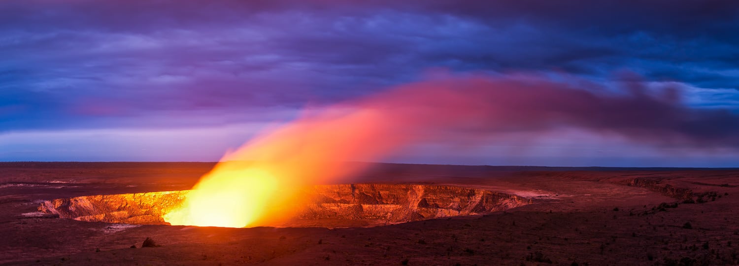
The big island volcano tracker consolidates real-time seismic data, gas emissions, and visual observations from Kīlauea and Mauna Loa into a single reference point. As of September 2026, Kīlauea remains intermittently active within Halemaʻumaʻu Crater, with visible lava lake activity dependent on magma supply rates, while Mauna Loa has been quiet since its 2022 eruption ended.
Kīlauea has erupted 34 times since 1952, making it one of the planet's most reliable volcanic laboratories. The summit crater, Halemaʻumaʻu, collapsed during the 2018 lower East Rift Zone event and has since rebuilt a lava lake that rises and falls with the volcano's breathing cycle. Monitoring this system requires a network of tiltmeters, GPS stations, and thermal cameras spread across the caldera floor and rift zones, all feeding data to the Hawaiian Volcano Observatory in near-real time. Mauna Loa, by contrast, erupts on a longer cadence—roughly once every six years over the past century. Its 2022 eruption sent flows down the northeast flank toward Hilo but stopped short of populated areas. The volcano's shallow magma reservoir sits three kilometers beneath the summit, and seismic swarms there signal when pressure is building. Between eruptions, Mauna Loa inflates steadily, a process tracked by satellite interferometry and benchmarked against decades of baseline measurements. Park access remains open during most volcanic activity, though road closures and air quality advisories activate when sulfur dioxide concentrations exceed safe thresholds. The Jaggar Museum overlook, destroyed in 2018, has not been rebuilt; current viewing relies on pullouts along Crater Rim Drive and the Kīlauea Overlook near the Volcano House. Night viewing offers the clearest thermal signature when lava is present, but cloud cover and vog—volcanic smog—can obscure the glow even during active phases. Understanding eruption forecasts requires distinguishing between seismic unrest and eruptive behavior. Elevated earthquake counts and ground deformation indicate magma movement, but not all unrest leads to surface eruptions. The big island volcano tracker interprets these signals in context, noting whether activity is confined to the summit or migrating toward rift zones where populated areas face greater risk. For visitors, the practical implication is straightforward: check the Observatory's daily update and the park's alert page before driving to the summit, and carry respiratory protection if you have sensitivities to volcanic gases.
“Kīlauea has erupted 34 times since 1952, making it one of the planet's most reliable volcanic laboratories.”
Big Island Volcano Tracker: Official Park Opening Hours
Hawaii Volcanoes National Park remains open 24 hours a day, seven days a week, allowing visitors to monitor volcanic activity at all hours. Access to the park continues throughout the year without daily closure periods.
| Monday | 00:00–23:59 | Open 24 hours |
|---|---|---|
| Tuesday | 00:00–23:59 | Open 24 hours |
| Wednesday | 00:00–23:59 | Open 24 hours |
| Thursday | 00:00–23:59 | Open 24 hours |
| Friday | 00:00–23:59 | Open 24 hours |
| Saturday | 00:00–23:59 | Open 24 hours |
| Sunday | 00:00–23:59 | Open 24 hours |
The Best Arrival Window for Your Big Island Volcano Tracker Visit
The best arrival window for your visit is 06:00–10:00. Arriving during this period helps you avoid peak crowds and ensures you secure parking, as spaces fill by late morning.
Early Morning
Low to moderate—
Arrive between 06:00–10:00 to secure parking and experience trails before peak congestion. This window offers the most reliable access to popular parking areas.
Mid-day
High—
Expect significant congestion at parking lots and popular viewpoints. Visitor centers and trails experience the highest density of guests during these hours.
Spring and Fall
ModerateMild with 65–75°F
These shoulder seasons offer stable weather conditions and fewer crowds than summer or winter holiday periods. Mid-week visits during these months provide the quietest experience.
Verdict: For the most efficient visit, plan to arrive between 06:00–10:00 on a weekday during the shoulder months of April or October.
Directions for Your Big Island Volcano Tracker Expedition
Hawaii Volcanoes National Park is located on the southeast coast of the Big Island. The most direct approach for visitors is via Hawaii Belt Road, also known as Highway 11.
Highway 11 to Crater Rim Drive
Highway 11 to Crater Rim Drive
Highway 11 to Crater Rim Drive
Big Island Volcano Tracker: Key Observation Areas and Sights
Hawaii Volcanoes National Park offers several primary observation zones accessible via the Crater Rim Drive corridor. These sites provide distinct vantage points to monitor volcanic activity and geological formations across the summit area.
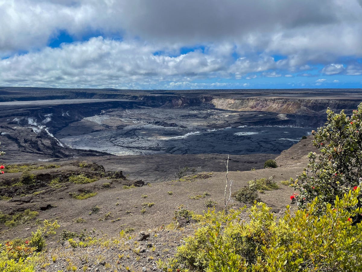
Kīlauea Overlook
This viewpoint provides a direct perspective of the Kīlauea caldera and the recent collapse features within the crater. It serves as a primary station for tracking seismic and thermal shifts.
Visit at dusk to observe potential glow from active vents.
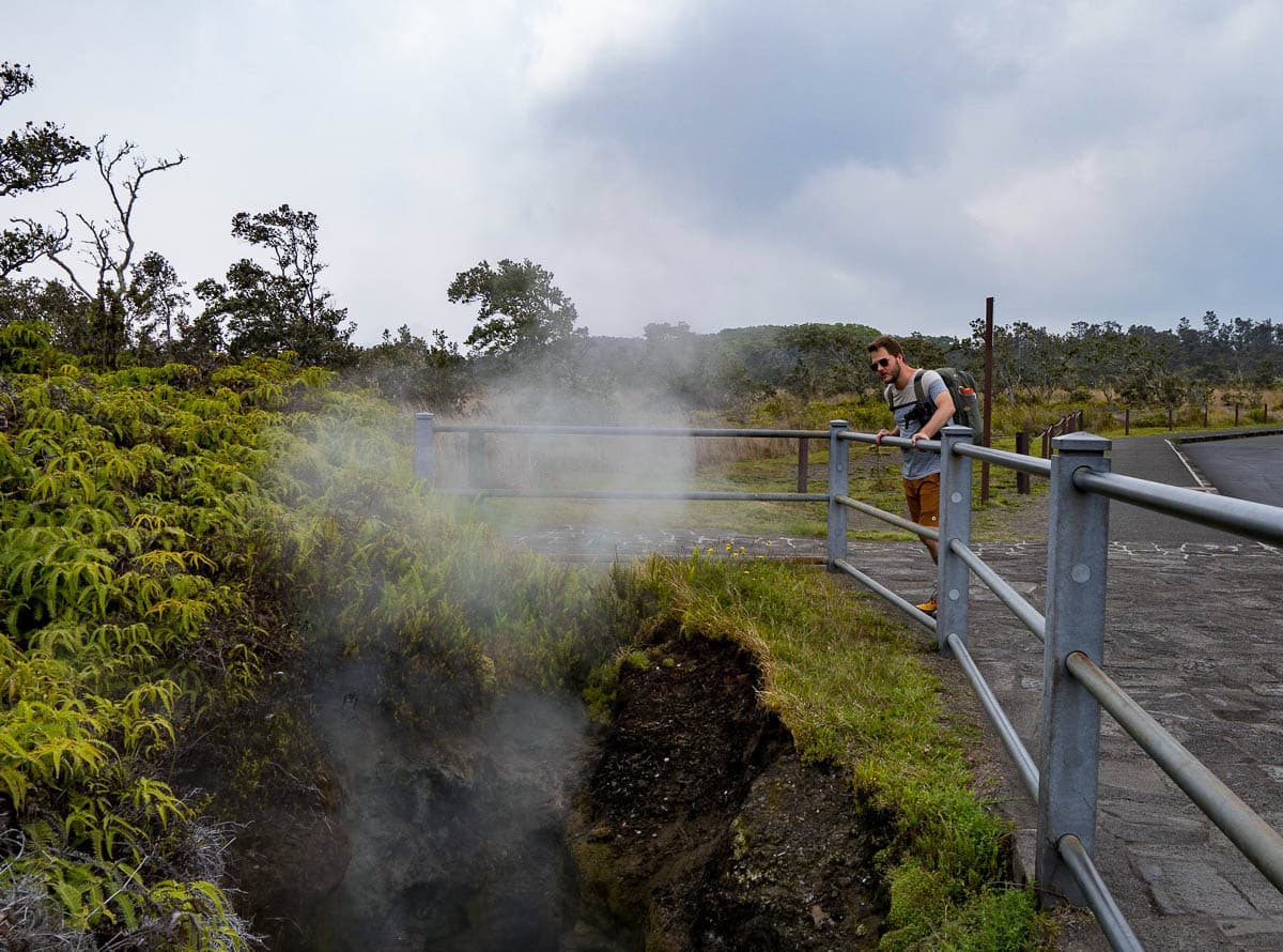
Steam Vents
Located near the caldera edge, these vents allow visitors to observe groundwater coming into contact with hot volcanic rock to create steam. The area features marked trails that move through the surrounding meadow.
Use the boardwalk path to avoid walking on unstable soil.
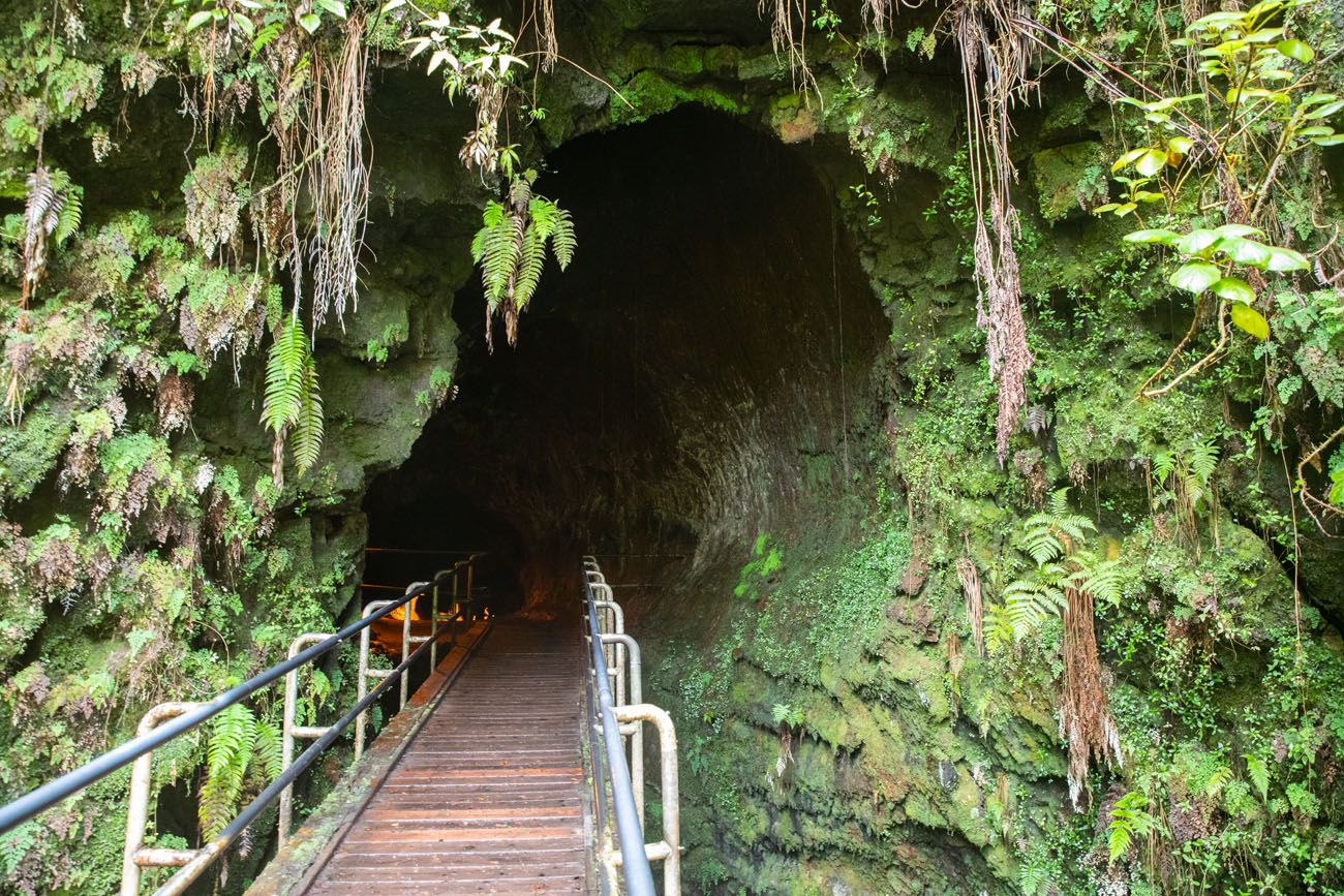
Thurston Lava Tube (Nāhuku)
This large lava tube offers a walk through a tunnel formed by flowing pahoehoe lava centuries ago. The surrounding rainforest provides a contrast to the barren volcanic landscape.
Bring a flashlight to examine ceiling mineral deposits.
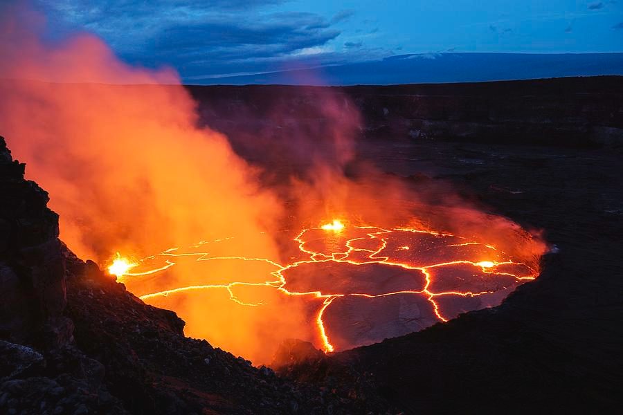
Halemaʻumaʻu Trail
This trail descends from the caldera rim onto the crater floor, bringing visitors closer to the historic site of recent eruptions. It crosses solidified lava lakes and geological fissures.
Stay on marked trails to ensure safe volcanic observation.
Big Island Volcano Tracker: Pre-Visit Essentials Checklist
The park's volcanic terrain and microclimates require specific gear and preparation for safe exploration.
-
Bring layers and a rain jacket — Temperatures drop with elevation and weather shifts quickly at the summit.
-
Pack sturdy closed-toe hiking shoes — Lava rock trails are uneven and sharp, requiring ankle support and grip.
-
Carry at least 2 liters of water per person — The dry volcanic environment and sun exposure increase dehydration risk on trails.
-
Download offline maps before arrival — Cell service is limited across much of the park's remote areas.
-
Check current eruption status on NPS alerts — Volcanic activity changes trail access and viewing conditions without advance notice.
-
Bring a flashlight or headlamp with batteries — Lava tube exploration requires your own lighting; rental options are not available.
-
Leave drones at your accommodation — Federal law prohibits drone use in all national parks without special permits.
Check availability
Frequently asked questions about big island volcano tracker
Everything you need to know about big island volcano tracker